Best Walking Route in New York
It can be difficult to plan the best walking route in New York. Lower Manhattan, crosses the Brooklyn Bridge on foot, and continues through DUMBO to the Brooklyn Heights Promenade. Others pass New York's different neighborhoods showcasing the many styles of the city.
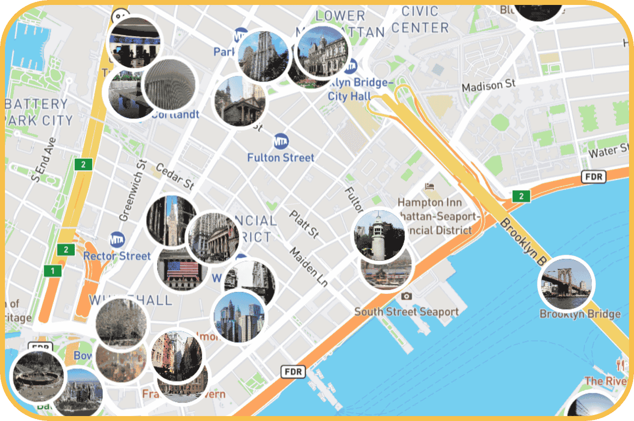
The best way to plan a walking route through New York is by using a smart interactive map like the one you find in the StoryHunt app. It makes it easy to get an overview of the top attractions and how to see them in one go.
Open the interactive map, set City Hall Park as your starting point, and get a ready-made route with all key stops marked and stories about each place ready as you walk.
What to see on New York's best walking route
New York is a remarkably walkable city, with Manhattan's attractions densely packed together, and crossing into Brooklyn on foot adds a completely different perspective of the city that most visitors miss by staying on the Manhattan side.
- Start at City Hall Park, Lower Manhattan. The park sits at the foot of the Brooklyn Bridge and is surrounded by some of New York's oldest civic architecture. The entrance to the bridge walkway is a short walk east from here.
- Cross the Brooklyn Bridge. The Brooklyn Bridge is one of New York's most iconic landmarks and the pedestrian walkway runs along the upper level above the traffic. The crossing takes around 30-40 minutes at a comfortable pace and gives you open views of the Manhattan skyline and New York Harbor on both sides.
- Walk through DUMBO. On the Brooklyn side, DUMBO (Down Under the Manhattan Bridge Overpass) is one of New York's most photographed neighborhoods. The cobblestone streets, the framing of the Manhattan Bridge between the buildings, and the concentration of independent restaurants and galleries make it a natural stop before continuing along the waterfront.
- Walk Brooklyn Bridge Park. The waterfront park runs south from the bridge along the East River with unobstructed views back across to Manhattan. It's free, open, and one of the best places in the city to slow down.
- Finish at Brooklyn Heights Promenade. The Brooklyn Heights Promenade offers one of the most celebrated views of the Manhattan skyline, looking directly across the river at Lower Manhattan and the Brooklyn Bridge from above. It's the natural endpoint and the best spot for photos on the whole route.
Practical tips for walking the Brooklyn Bridge route

- Start from the Manhattan side. Walking east to west means the Manhattan skyline is ahead of you for the entire crossing. Starting from Brooklyn puts it behind you.
- Go early. The Brooklyn Bridge walkway gets extremely busy by mid-morning, especially on weekends. Walking before 9am means a noticeably quieter experience.
- Allow 3 to 4 hours. The route covers around 5-6 km but DUMBO and Brooklyn Bridge Park are easy places to lose an hour without noticing.
- Use the StoryHunt map to take detours. The interactive map shows nearby stops just off the main route, like the 9/11 Memorial and the South Street Seaport, that fit naturally into the walk from the Manhattan starting point.
Let StoryHunt plan the best walking route in New York

Rather than following a static list, the StoryHunt app adapts to where you are on the route.
The interactive map shows all the key stops from Lower Manhattan through Brooklyn, lets you choose how much time you have, and adds context about each place as you arrive.
It works the same way across New York's other great walking routes and in cities worldwide, so the same tool that guides you over the Brooklyn Bridge works just as well in Central Park, the High Line, or on your next trip to a new city entirely.
